WEGA in the North West United States
May 29th to June 11th 2016
Return to "Day" page
Return to Day 13 Page
Geological Background
The Front Ranges, of which the Rockies are part, run N-S from Wyoming through Colorado rising some 10,000’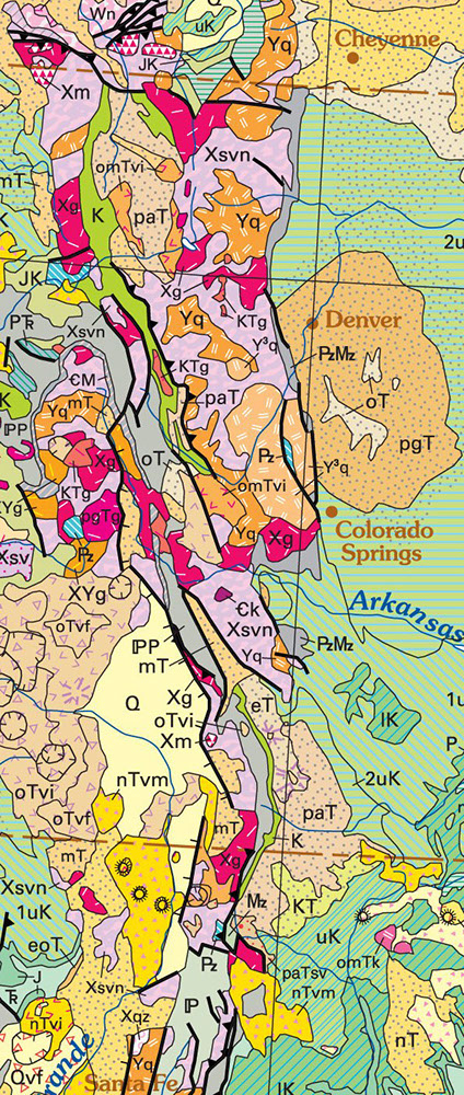 above the Great Plains. Some of the peaks reach 14,000 of which there are 53 14ers in Colorado. The front ranges represent blocks of the Proterozoic crystalline basement of the North American crust that have been block upfaulted during the Larimide orogeny. Cross-cutting these blocks is a 500km long Proterozoic shear zone trending NE-SW from La Plate to near Boulder that forms the Colorado Mineral Belt. The zone is intruded by numerous Larimide (75-45 Ma) igneous bodies from which the mineralizing fluids were derived.
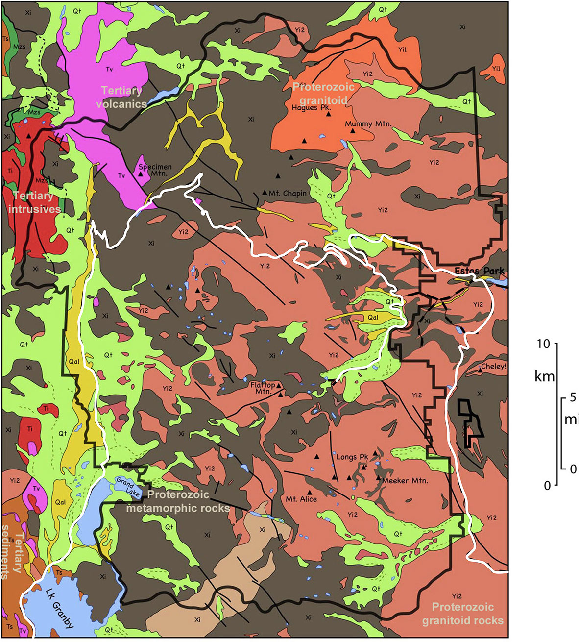
The Rocky Mt National Park geology is part of the Front Range and is dominated by blocks of crystalline Proterozoic basement rocks, consisting of schists, gneisses and granitoid rocks ranging in age from 1.7 – 1.4 Ga. These rocks formed an early mountain range – “the ancestral Rocky Mts” – during the Palaeozoic and Mesozoic when sediments eroded from the mountains were deposited in shallow seas to form the Fountain Formation which now form the flatirons along the frontal ranges. Also rocks of the Permian and Cretaceous were also deposited in the area, that now host the abundant faunas found in these rocks.
Between 29-24 Ma granites were intruded in the north western area of the park, with some magma reaching the surface and forming volcanoes. Lava flows and ashes from these eruptions are seen in several parts of the park. The tectonic origin for this magmatic event is unknown.
The route across the Front ranges to Boulder is via US-40, one of the highest paved roads in the US reaching over 12,000 in the tundra ecosystem. Even in June the road may be subject to occasional closures because of snow cover.

Granby lies in one of the N-S valleys marking a fault zone at one of the basement uplifts. The route north on US-40 is across Quaternary infill in the valley. Some 8 miles north of Grand Lake on the west are a number of 12,000’+ peaks that are part of the Tertiary volcanic complex. The route then turns east climbing up many zigzags up Millner pass. The start of the climb crosses the frontal faults, and into the Early Proterozoic metamorphic basement, and continues to climb to the Continental Divide at 10,759’. The road then continues to climb to the highest point of 12,183’, before dropping to the east and entering mid-Proterozoic granitoid rocks from Rock Cut eastwards.
Return to Day 13 Page